


A brief cooldown has arrived for today and tomorrow, with a round of light accumulating snow overnight impacting the Monday morning commute.
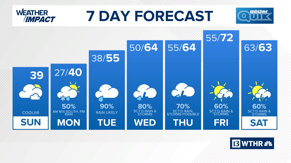
INDIANAPOLIS — A brief cooldown has arrived for today and tomorrow, with a round of light accumulating snow overnight impacting the Monday morning commute. A warmer, but more active pattern with heavy rainfall begins Tuesday.


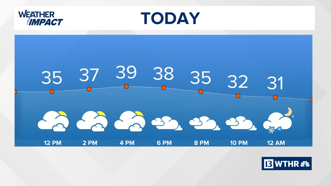
Today
Cooler air has returned for today with temperatures holding steady in the 30s. Lots of dry time today with a mix of sun and clouds through the day ahead of a quick wave of wintry precipitation set to move in overnight.

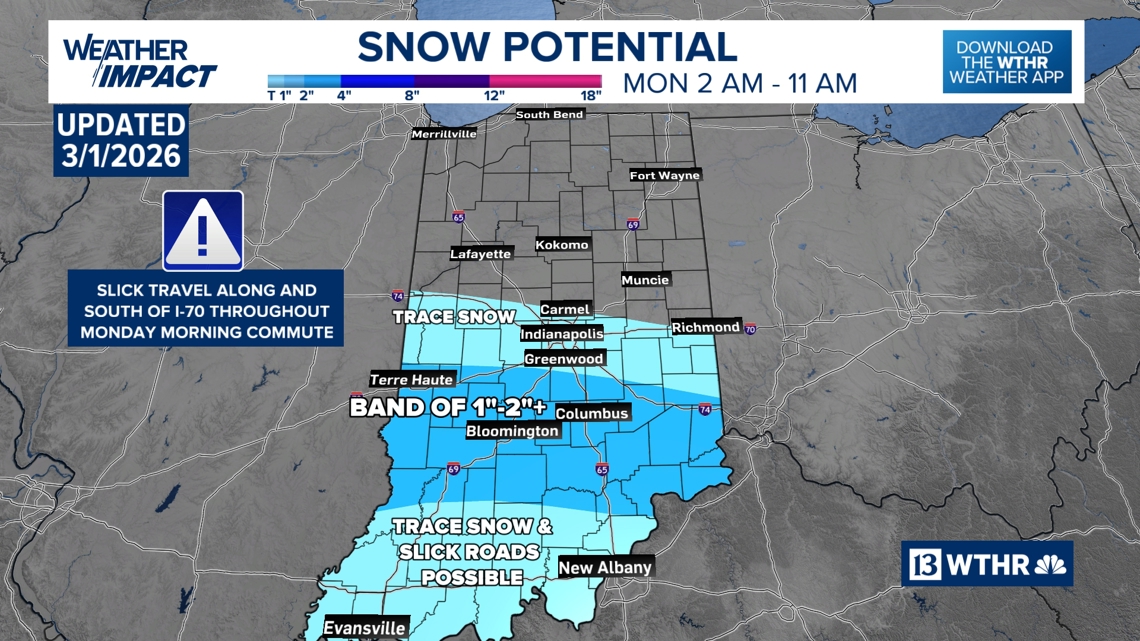
Slick spots possible Monday morning (mainly south)

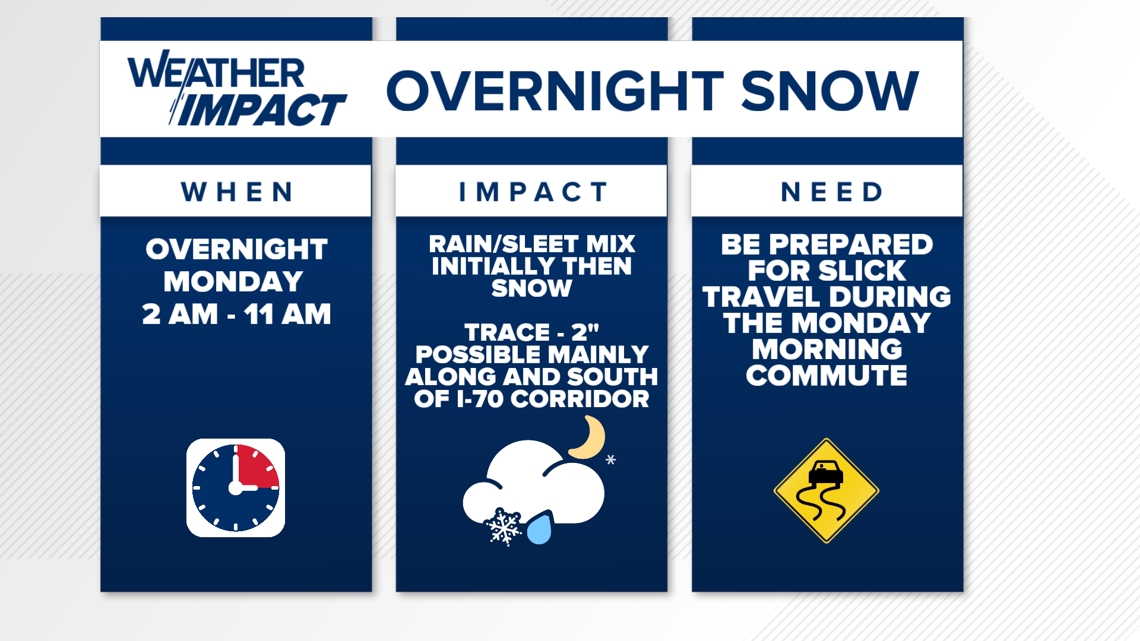
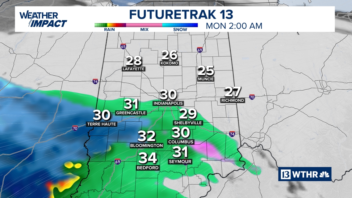
We’ve been monitoring a storm system for the overnight hours which has now shifted back northward into central Indiana. The target impact zone will be from the Crawfordsville-Carmel-New Castle line and points south.
This will likely begin as a rain/sleet mix with a layer of warmer air just above the surface starting around 2 a.m., then become all snow as temperatures drop overnight.


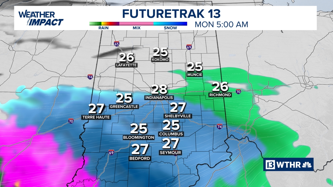

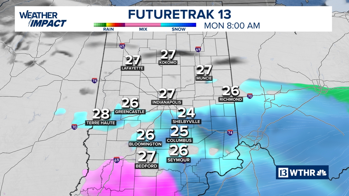
There is the potential of a few snow bands setting up where slightly higher snowfall totals will be possible (2″+). While this won’t be a major snow event, the timing will create slick conditions that could slow down the Monday morning commute.

Tomorrow
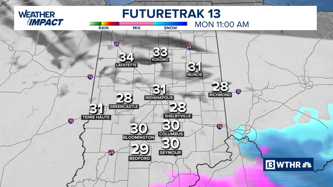
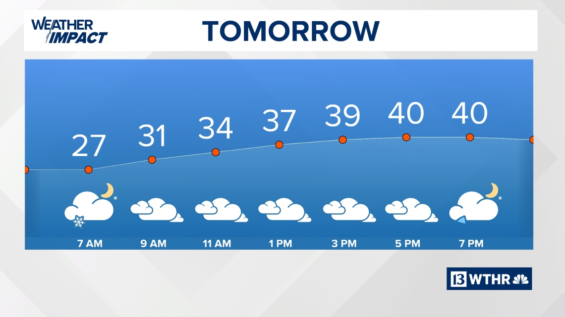
This wave will wrap up by the mid-morning hours on Monday. Temperatures remain cool with highs near 40 Monday afternoon, warm enough, though, to start melting away any snow that has accumulated. We’ll stay mainly dry through the day with our next weather system bringing rain back into the area by late Monday evening.


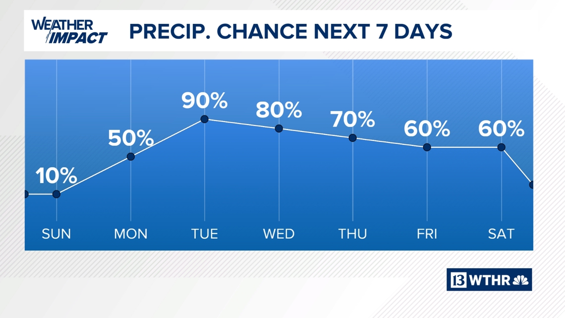
Wet, active pattern begins Tuesday

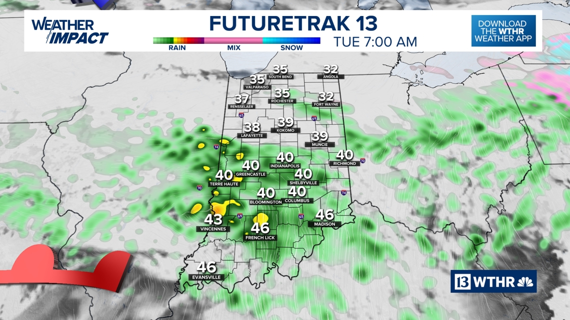

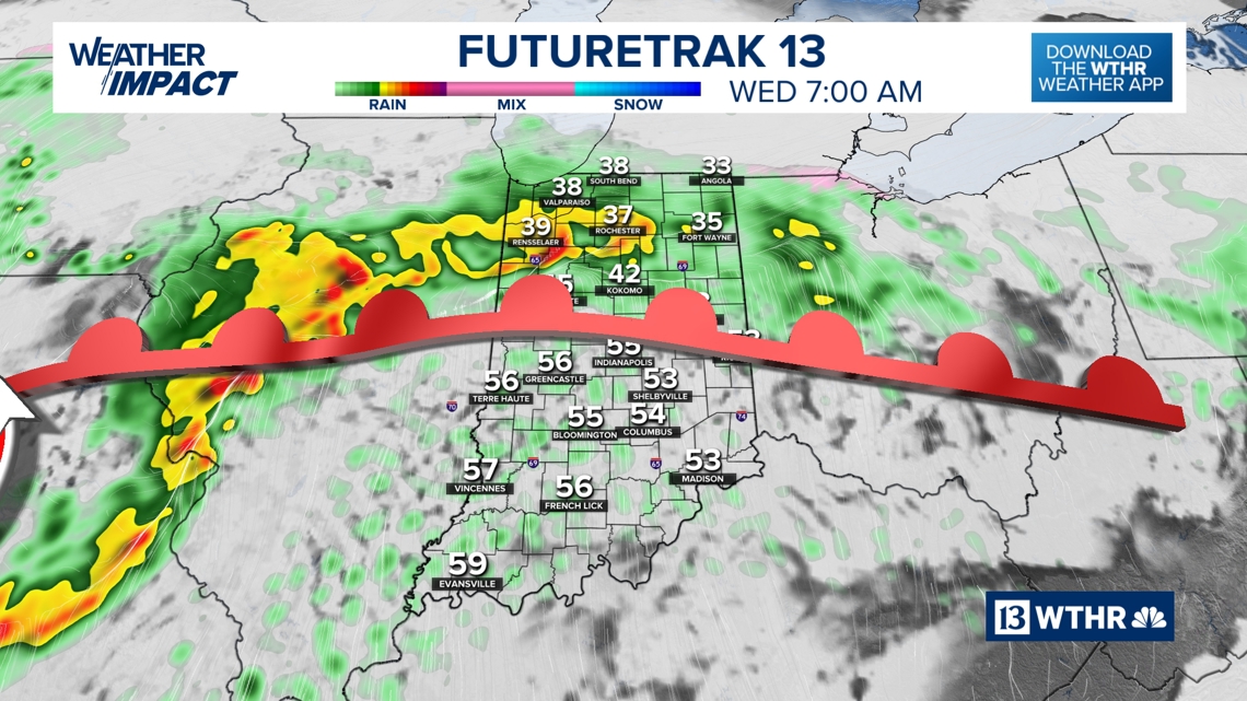
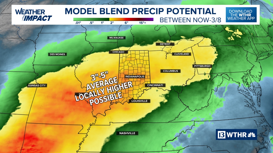
Several weather systems are set to impact central Indiana during the next seven days. Amplified by a southerly wind adding warmer air and moisture into the mix, several rounds of heavy rain with some thunderstorms will be possible. The exact timing of heavy rainfall remains uncertain, but signs of an active pattern through next weekend will bring several inches of rainfall and an increased risk of localized flooding and elevated river levels.


– 13Meteorologist Lindsey Monroe
