


NASHVILLE, Tenn. (WSMV) – Stay weather aware through late Thursday evening.
FIRST ALERT WEATHER DAY – THIS EVENING
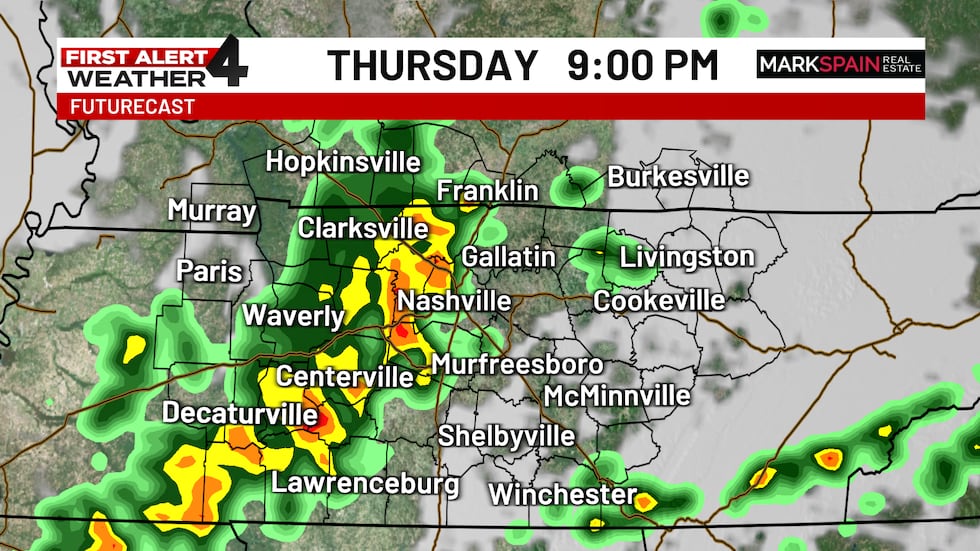
A First Alert Weather Day is in effect through this evening due to the threat for a severe thunderstorm or two. Anywhere in Middle Tennessee and southern Kentucky is fair game for downpours, brief gusty wind, and/or hail. Tornadoes are unlikely.
The greatest storm threat will affect western Middle Tennessee and southwest Kentucky between 5 pm and 8 pm. Nashville’s highest chance for rain and/or storms is 7 pm – 10 pm. Storms will march southeastward from there, likely getting to the Cumberland Plateau between 9 pm and midnight.
Stay weather aware. Get live updates from the First Alert Weather Team on WSMV4, online, and on the WSMV4 and First Alert Weather apps.
For life-saving weather alerts, customized messages on conditions and forecasts, and videos detailing upcoming weather events, download the WSMV 4 First Alert Weather app for iPhone or Android. Have weather pictures or videos? Share them here.

While there may be a few showers early in the day, the storms that develop in the late afternoon and evening could easily produce heavy rain, and the strongest storms could have wind gusts over 50 mph and even some hail.
There is no threat of tornadoes, however.
Copyright 2025 WSMV. All rights reserved.
