


DALLAS – A rainy start to Tuesday will give way to lingering showers through Wednesday. Residents should prepare for a stormy weekend, as severe weather is possible during the afternoon and evening hours both Saturday and Sunday.
Tuesday’s Forecast
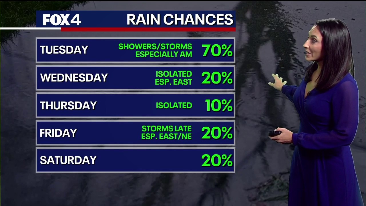
Expect a wet commute this morning as a disturbance brings widespread showers and isolated thunderstorms. While severe weather is not anticipated today, these storms will produce frequent lightning and heavy rain. Afternoon highs will be cool, only reaching the low to mid-60s.
LIVE Radar: Dallas-Fort Worth

7-Day Forecast

Moisture will keep rain chances in the forecast for Wednesday, particularly east of DFW. A warming trend begins mid-week, with highs climbing into the mid-70s.
While the workweek remains mostly quiet with gradually rising temperatures, our attention shifts west by Friday. A developing dryline is expected to trigger storms each afternoon and evening through the weekend.
Weekend Weather Alert

An unsettled and stormy pattern returns to North Texas this weekend. Strong thunderstorms are possible across parts of the Metroplex as early as Friday.
While specific details regarding timing, coverage, and intensity remain uncertain, the potential for severe weather is increasing. Those with outdoor plans should stay weather-aware and check for updates as the weekend approaches.
The Source: Information in this article comes from the National Weather Service and FOX 4 Forecasters.
